About DMZ
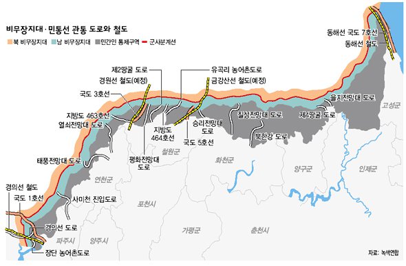
- It is an area established along the Military Demarcation Line (MDL) under the Armistice Agreement (July 27, 1953).
- The military demarcation line prohibits the presence of troops or the deployment of weapons in a space of 2km each north-south (South-North) 4km wide (East-West) and 240km long (East and west.
- In general, the area where DMZ peace tourism takes place is a wide range of DMZs, including civilian control zones and border areas, including the 4km north-south area (the DMZ of consultation) based on the military demarcation line.
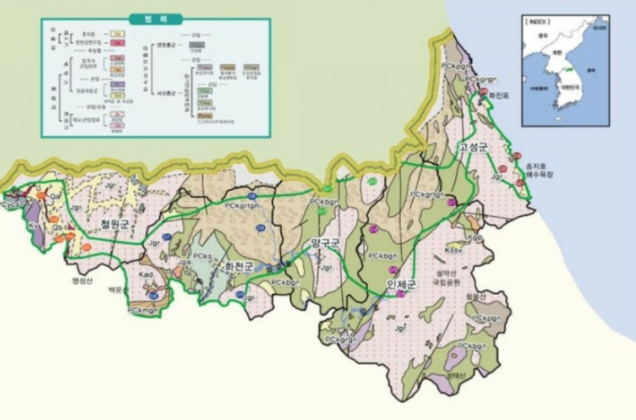
- There are a total of 15 cities and counties in the border area. Ganghwa-gun, Ongjin-gun, Gimpo-si, Yeoncheon-gun, Gyeonggi-do, Cheorwon-si, Hwacheon-gu, Inje-gun, and Goseong-gun (10 cities and counties) in Gangwon-do are directly bordered by the Southern Limit Line under the Military Demarcation Line, and adjacent Goyang-si, Dongducheon-si, Gangwon-do (5 cities and counties) are also included.